Agri - Climate
Agro-climatic zones
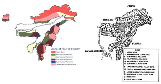 |
Agro-climatic zones of Meghalaya including North East India
Climatic Classification
In order to identify the regional climates of North East India keeping parity with the prevailing characteristics the climates may be identified as follows (a) Dfh – Humid continental, severe winter, moist in all seasons and short summer, (b) Cwa - Subtropical monsoon, mild dry winter (c) Cwb – Subtropical monsoon, mild dry winter, warm and humid summer with winter fogs (d) Cwm – subtropical humid monsoon with very heavy summer rains (Borthakur ’86)
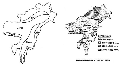 |
Climatic classification of NE Region Rainfall pattern of North Eastern Hill Region
Products of agro-meteorological data analysis
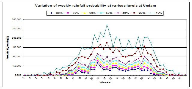 |
Variation of weekly rainfall probability at various levels at Umiam
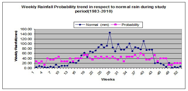 |
Weekly rainfall probability trend in respect to normal rain
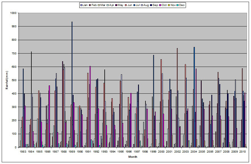 |
Monthly distribution of rainfall during the period 1983-2010
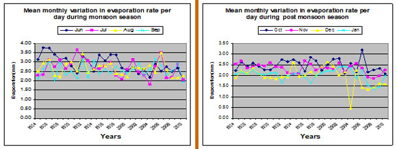
Mean monthly evaporation analysis
 |
i) ii)
i) Mean monthly variation in evaporation rate during monsoon season
ii) Mean monthly variation in evaporation rate during Post monsoon season
i) ii)
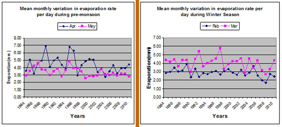
i) Mean monthly variation in evaporation rate during Pre-monsoon season
ii) Mean monthly variation in evaporation rate during Winter season
Climatic Atlas
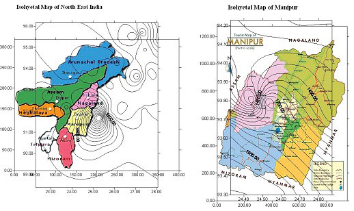
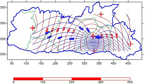
Isohyetal map of north eastern region as well as Manipur State
Isohyets of monsoon and mean annual Isohyets of Meghalaya
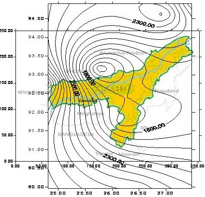
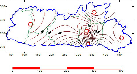
Isohyetal Map of Assam
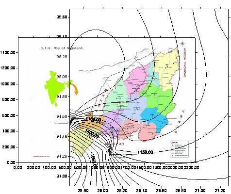
Isohyetal Map of Nagaland
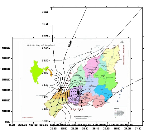
Isothermal Map minimum temperature of Nagaland
Isohyetal Map of Mizoram
Dry and Wet Spell analysis
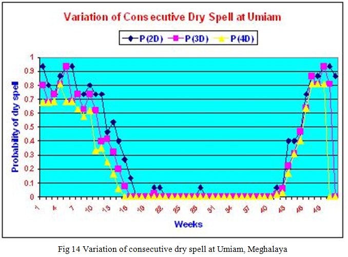
Crop planning is backward and forward accumulation of rainfall to determine the onset and termination of the wet season based on precipitation. Cropping strategies are greatly influenced by the variability of the onset and end of the rainy season. The weekly rainfall limit for Umiam is 20mm., which means a week is considered as wet, if the total rainfall in that week is equal to more than 20mm; otherwise the week is dry. Analysis shown that the probability of occurrence of dry spell is very high (53% to 100%) in the first 15th weeks of the year. Then the pre-monsoon shower starts and probability of dry week falls from 46% to 6% during 16th to 21st week and during monsoon (i.e. from 16th week to 42nd week), it varies between 13% and 0%. The Fig 14 shows the variation of consecutive dry spell at Umiam, Meghalaya.
Global warming impact on Meghalaya Climate
Meghalaya showed a change in the climatic pattern over the last 27 years (1983-2010). The study has shown the annual mean rainfall is increasing slightly but not significant in nature although year to year variation is quite significant (Fig 15). The monsoon rainfall reduced but post monsoon rainfall increased significantly. The trend of shifting of monsoon rainfall is predominant after 2001. The mean annual maximum temperature is increasing significantly whereas slight decreases of annual mean minimum temperature. The difference between maximum and minimum temperature is increasing which denotes a warmer climate with greater variability.
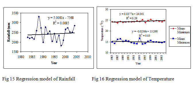
Regression analysis (Fig 16) of historical data has shown the mean annual maximum temperature is increasing significantly. A little bit decreasing trend of annual mean minimum temperature has been revealed in the study. As difference between maximum and minimum temperature is increasing it denotes a warmer climate with greater variability. The annual mean rainfall is increasing slightly but not significant in nature though year to year variation is quite significant
Hence, though a change has been observed in the climatic pattern of Meghalaya, it will be premature to consider it as a climate change at this point. The changes in climate of the state can not be concluded that it is because of global warming impact or any other localized temporary phenomenon. It can be accepted that some sort of changes taken place in the local weather but it can not be considered as climate change. To mitigate these changes steps have to be taken up to cope up with the current situation in a more cohesive and scientific way keeping in view of limited resource base of the region. Although highest rainfall area of world is located in this state, water is a scarce resource due to non availability of sufficient rainwater harvesting. Therefore judicious use of water may be advocated through multiple-use of water, water harvesting and rainwater harvesting for future generation. The traditional agro-forestry practices and bamboo drip irrigation may also to be addressed.
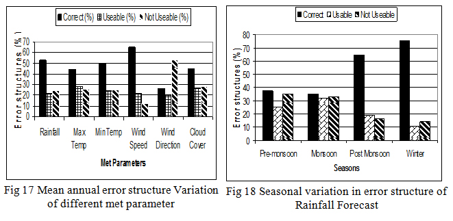
Performance of medium range weather forecast at Ri-bhoi district of Meghalaya
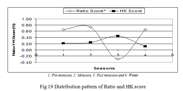
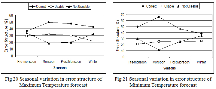
The study on the performance evaluation of medium range weather forecast for the period of fourteen years from April, 1997 to March, 2010 was analyzed for Ri-Bhoi District of Meghalaya state and presented in this paper. Fourteen years forecast data received from National Centre for Medium Range weather Forecasting (NCMRWF) and India Meteorological Department (IMD) were analyzed qualitatively and quantatively using skill score and critical values for error structure for validation by comparing with the observed meteorological parameters. Fourteen-year’s data on seasonal forecasts verification indicated that 75.1% of forecasts of rainfall were ‘Correct’ during winter followed by 64.6% in the post monsoon period. About 35.1% forecasts were ‘not usable’ during pre-monsoon followed 32.9% during monsoon. Nearly 50% forecasts of maximum temperature were ‘Correct’ during monsoon season and less than 50% during rest of the seasons. The maximum 33.58% forecasts were ‘not usable’ during Pre-monsoon season in case of maximum temperature. Nearly 65.5% forecast of minimum temperature was found ‘Correct’ during monsoon season followed by 49.31% during pre-monsoon. More than 60 percent forecast of Wind Speed were ‘Correct’ through out the year and the season. The analysis showed Wind direction is the only parameter that showed a reverse verification trend than the other parameters and gave more than 50% unusable. The highest 55.1% forecast of Cloud were ‘Correct’ in the monsoon only. Analysis also established a good correlation with Correlation Coefficient (CC) value of 0.58 between observed and forecasted maximum temperature during monsoon season with an annual mean CC value of 0.47. The most significant correlation with CC value of 0.85 was found during winter season with annual mean CC value of 0.42 in case of minimum temperature analysis.